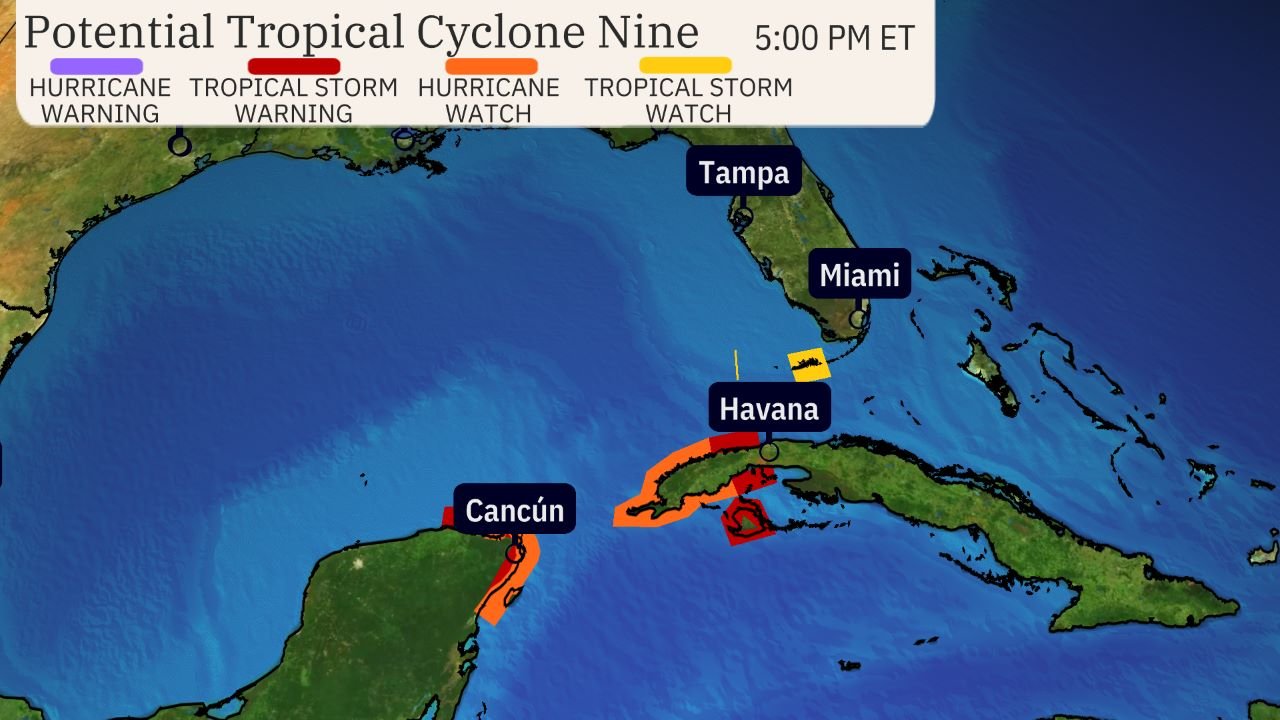
Watches and warnings issued: Tropical alerts have been issued for parts of the Yucatan Peninsula, the Greater Antilles, and Florida.
This means tropical storm conditions are expected, and hurricane conditions are possible in these areas within the next 36-48 hours.
Current situation: A strengthening tropical cyclone is in the western Caribbean Sea. Thunderstorms in the area are becoming more organized.
The storm was named Potential Tropical Cyclone Nine by the NHC on Monday morning, a procedure used to issue watches and warnings before the formation of a tropical depression or storm.

Here is the timeline:
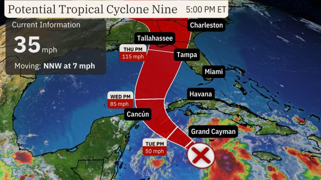
- Tuesday: The storm is expected to approach Cancún, Cozumel, and western Cuba as a named storm, Helene, at either tropical storm or Category 1 hurricane intensity. Heavy rain, strong wind gusts, and storm surge flooding are possible in these areas. Some parts of western Cuba could see over 12 inches of rain.
- Wednesday: Helene may continue to impact Cancún, Cozumel, and western Cuba, especially early in the day. Helene is then expected to enter the southern Gulf of Mexico as a hurricane. High surf and outer rainbands could reach parts of Florida’s Gulf Coast, from the Keys to the Panhandle.
- Thursday: Despite some uncertainty in the forecast, Helene is projected to make landfall as a major hurricane on Thursday afternoon or evening. While models suggest the most likely landfall location is from Florida’s Big Bend to the Panhandle, hurricane impacts (storm surge, winds, rain) can occur far from the center. There are still model forecasts showing tracks as far east as Florida’s West Coast and as far west as southeast Louisiana or Mississippi. Therefore, everyone along the northern Gulf Coast from Louisiana to Florida should continue to monitor the forecast.
- Friday: The system is expected to push inland quickly, with lingering strong wind gusts and locally heavy rain affecting parts of the Southeast.
How strong could it become: Helene is forecasted to reach major hurricane strength in the Gulf before landfall.

One factor contributing to intensification is the high heat content in the northwest Caribbean Sea and parts of the Gulf of Mexico. According to University of Miami tropical scientist Brian McNoldy, Gulf of Mexico heat content is at a record high for this time of year.
But it’s not just the warm water. Forecast models indicate upper-level winds may spread apart over Helene, which is favorable for strengthening, rather than shearing and weakening the storm’s circulation.
For these reasons, Helene could reach at least Category 3 strength in the eastern Gulf of Mexico before making landfall.


